
Mt. Kurikoma Overview
Japan has some of the most beautiful untouched forests I have ever seen. I am an avid hiking enthusiast and amateur mountain climber so this summer I was thrilled to discover some of the local mountains are forests in my area. This first post will be about my favorite local spot in Miyagi Prefecture, Mt. Kurikoma.
Kurikoma is one of the five big mountains in Miyagi and is a popular vacation spot for locals, but mostly unknown to tourists and guidebooks. The mountain is located in the northern part of the prefecture, near the border of Iwate Prefecture. It is easily accessible by car and is located in Kurihara. See the map below for details. You can take route 4 most of the way, turning on the local route 42 that will take you all the way up. It is easy to find and clearly marked in English and Japanese so you should have no issues getting there. There is a notable waterfall that I would definitely check out right on the side of the road. It is well marked so you won`t miss it. There many other off roads, onsen, and hiking spots all over the mountain that I have yet to explore, but it is filled so you will not have any trouble finding things to do.
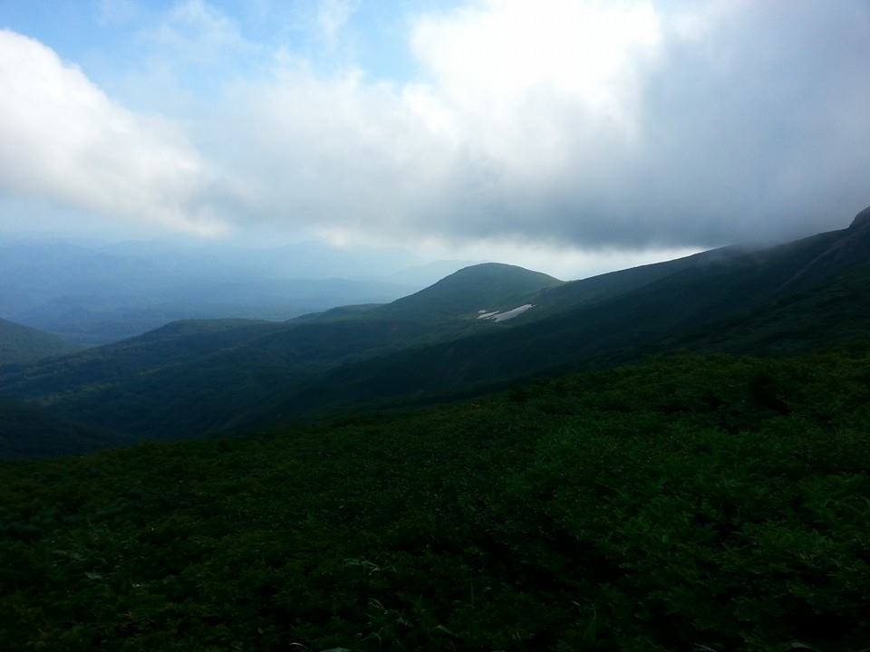
The main hike starts in a parking lot at the very end of the main road. Drive until you hit a very large parking lot with a restaurant, bathroom, and gift shop. Walk up the paved road to the gift shop, and to the right behind it will be the trail access. The trail is well maintained and actually paved with stone stairs for the first two hours of the hike. If you go in the summer there will be insane amounts of dragonflies, but not too many mosquitoes (thanks to the dragonflies) so as long as you are not afraid of harmless bugs, it is a lovely day. For the beginning of the trail it is quite a steep grade, and will start off fairly difficult, but soon after, the trail will become more gradual and the trees open up a bit. This will be a relief for now you should be able to see the view of the surrounding mountains, and also a nice breeze should start to permeate the trail. After you break the tree line, the course opens up into a beautiful alpine
field. You can stop before the summit for a water break. There should be a trail map of the park, and plenty of places to sit down in the clearing and relax in the cool mountain weather. After this it is about 30 minutes to reach the summit, depending on how slow you walk. At this point there is another trail that branches off to the right and follows the ridgeline to a second peak, then drops down and meets up back at the parking area. I took the path once to make a loop out of the hike and it was fun, but there is a family of bears in the area so take caution. We did see them from a distance and it was a mother with two cubs so it may be dangerous. If you decide to take the second trail, be warned as well that part of the trail follows a river, and there is no place to walk except in the river itself. This can be fun if you want to try some rock hopping, but it may be dangerous and wet as well, so go at your own risk.
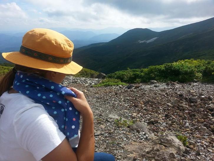
To continue on to the summit, ignore the path on your right, and follow the main trail up to the top. It is VERY well maintained and you should have no problems, but we careful! There is a steep drop off on one side of the trail. This should not be a problem as there is plenty of room on the trail itself, but be aware of your footing. If there is no cloud cover, you should have a fantastic view of the surrounding mountain range, and you may even be able to see Mt. Iwate in the distance. Have a lunch break up here, give an offering to the shrine if you are into that sort of thing, and head back down when you are ready. The whole hike takes about 2-3 hours if you do the main path in and out, and about 4-5 hours if you take the loop. Overall it offers fantastic views, wildlife sightings, and it is not all that difficult for the casual hiker. Please be careful, but enjoy one of Miyagi`s treasures to the fullest!
Kurikoma is one of the five big mountains in Miyagi and is a popular vacation spot for locals, but mostly unknown to tourists and guidebooks. The mountain is located in the northern part of the prefecture, near the border of Iwate Prefecture. It is easily accessible by car and is located in Kurihara. See the map below for details. You can take route 4 most of the way, turning on the local route 42 that will take you all the way up. It is easy to find and clearly marked in English and Japanese so you should have no issues getting there. There is a notable waterfall that I would definitely check out right on the side of the road. It is well marked so you won`t miss it. There many other off roads, onsen, and hiking spots all over the mountain that I have yet to explore, but it is filled so you will not have any trouble finding things to do.
The main hike starts in a parking lot at the very end of the main road. Drive until you hit a very large parking lot with a restaurant, bathroom, and gift shop. Walk up the paved road to the gift shop, and to the right behind it will be the trail access. The trail is well maintained and actually paved with stone stairs for the first two hours of the hike. If you go in the summer there will be insane amounts of dragonflies, but not too many mosquitoes (thanks to the dragonflies) so as long as you are not afraid of harmless bugs, it is a lovely day. For the beginning of the trail it is quite a steep grade, and will start off fairly difficult, but soon after, the trail will become more gradual and the trees open up a bit. This will be a relief for now you should be able to see the view of the surrounding mountains, and also a nice breeze should start to permeate the trail. After you break the tree line, the course opens up into a beautiful alpine
field. You can stop before the summit for a water break. There should be a trail map of the park, and plenty of places to sit down in the clearing and relax in the cool mountain weather. After this it is about 30 minutes to reach the summit, depending on how slow you walk. At this point there is another trail that branches off to the right and follows the ridgeline to a second peak, then drops down and meets up back at the parking area. I took the path once to make a loop out of the hike and it was fun, but there is a family of bears in the area so take caution. We did see them from a distance and it was a mother with two cubs so it may be dangerous. If you decide to take the second trail, be warned as well that part of the trail follows a river, and there is no place to walk except in the river itself. This can be fun if you want to try some rock hopping, but it may be dangerous and wet as well, so go at your own risk.
To continue on to the summit, ignore the path on your right, and follow the main trail up to the top. It is VERY well maintained and you should have no problems, but we careful! There is a steep drop off on one side of the trail. This should not be a problem as there is plenty of room on the trail itself, but be aware of your footing. If there is no cloud cover, you should have a fantastic view of the surrounding mountain range, and you may even be able to see Mt. Iwate in the distance. Have a lunch break up here, give an offering to the shrine if you are into that sort of thing, and head back down when you are ready. The whole hike takes about 2-3 hours if you do the main path in and out, and about 4-5 hours if you take the loop. Overall it offers fantastic views, wildlife sightings, and it is not all that difficult for the casual hiker. Please be careful, but enjoy one of Miyagi`s treasures to the fullest!
 RSS Feed